-
ADAM will be participating in the Hong Kong Construction Innovation and Technology Fund's COVID-safe virtual conference CITF ConTech 2020
from the 15th of September to the 13th of October, 2020, with a video presentation from our Sales and Marketing Manager Kevin Ha (in Cantonese with English subtitles)
2:30 PM Hong Kong time on the 15th of September followed by a live chat session in both English and Chinese with Kevin and Managing Director Jason Birch until 3:45 PM.
(Click on "Technologies Sharing" and then "Advanced Design and Manufacturing Pty Ltd" to access our virtual booth.) Please join us and register now!
建造業創新及科技基金 Construction Innovation and Technology Fund (CITF) ConTech 2020. 一齊體驗360°建造業創新科技領域www.citf2020.com!
-
In-house and onsite training are now available once again in Western Australia; however travel restrictions and quarantine requirements mean that they are only available to customers already
within Western Australia. Online training remains available, as is phone and email support.
-
In light of recent developments with COVID-19 and the impending shutdown of non-essential services across the country, ADAM Technology will not be conducting in-house or onsite training from 23rd March until 30th April 2020, at which point the situation will be reviewed again.
Online training is still available, as is phone and email support. ADAM staff are all able to successfully work from home so even during a total shutdown ADAM will still be able to continue operating.
We appreciate your understanding in this unprecedented situation.
-
ADAM will be in booth 77 at AusIMM's Underground Operators Conference 2020 from the 25th to the 27th of March, 2020, in Perth.
Update: Due to the COVID-19 pandemic this conference has been
rescheduled to the 15th to the 17th of March,
2021.
-
ADAM will be in booth 30 at the
Slope Stability 2013 International Symposium from the 25th to the 27th of September, 2013, in Brisbane.
-
ADAM will be in booth 27 at the
56th Annual Meeting of the AEG from the 10th to the 13th of September, 2013, in Seattle.
-
ADAM will be in booth 81 at the
Iron Ore 2013 Conference from the 12th to the 14th of August, 2013, in Perth.
-
LiDAR News has an article on UAVs that mentions ADAM Technology and 3DM Analyst Mine Mapping Suite.
-
3DM Analyst Mine Mapping Suite and the ADAM Underground Field Kit were shown on ABC TV's Catalyst program on the 14th of February, starting just after the 8 minute mark of the program, demonstrating the process of capturing the images and illustrating the value of obtaining accurate 3D models of the excavation.
-
ADAM will give a talk entitled "Underground Applications of 3DM Analyst Mine Mapping Suite" at the
EAGCG Workshop on New Technologies in Ground Control from the 17th to the 18th of April, 2013, in Brisbane.
-
ADAM will be in booth 2104 at the
2013 SME/CMA Annual Meeting & Exhibit from the 24th to the 27th of February, 2013, in Denver.
-
The Sydney Morning Herald has
an article on UAVs that mentions ADAM Technology.
-
ADAM will be in booth 4 at the Eighth AusIMM Open Pit Operator's Conference 2012
on the 18th and 19th of September, 2012, in Perth.
-
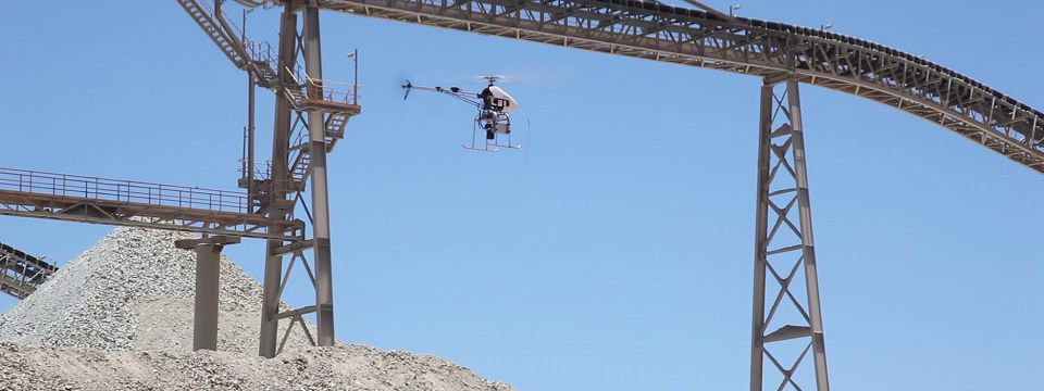
Added a video to our YouTube channel and an accompanying
blog post on the use of UAVs with 3DM Analyst Mine Mapping Suite, featuring
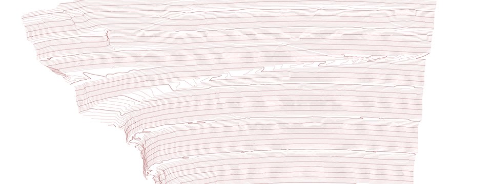
video footage taken from a UAV and the entire process of transforming the captured images into DTMs.
-
iTnews has published the first of three articles
on the use of UAVs at mine sites in Australia, featuring many images of our aircraft in operation as well as some images of the results.
HELImetrex, one of ADAM Technology's customers, is also quoted heavily.
The minesite featured in some of the images was originally using a laser scanner but has now been using UAVs for End-of-Month Crushed Ore Stockpile
surveys instead for the last two years. Following the success of the UAV they have expanded its use from a single eight-minute flight over the COS
once per month to 11 missions every month covering in excess of 8 km2 capturing pit walls, ROMs, the leach drain, block cave subsidence
zone, and the COS.
Prior to taking delivery of the UAV the site conducted a benchmark trial, doing a direct comparison with the laser scanner. This was complicated
by the fact that the laser scanner took three hours to scan the stockpiles while the UAV images were captured in the space of three minutes,
so some differences would be expected purely because of the movement of material during that time. In spite of that the results were within 0.3% of
each other, and well within their acceptance criteria.
-
The June edition of Geoinformatics has an article on
3DM Analyst by Adam Spring that includes the following quote:
"After using free software and testing other packages like Photoscan and Photomodeler 3DM Analyst is in a different league in terms of camera
calibration, flexibility of application, meshing capabilities and provenancing of work flow. It is a joy to use and exciting to be able to say we are
the first university and department in the UK to have it."
Dr. Caradoc Peters, Head of Archaeology, University of Plymouth
-
ADAM will be in booth 31 at the ISPRS 2012 Congress
from the 25th of August to the 1st of September, 2012, in Melbourne.
-
ADAM will be in booth 2 at the 46th U.S. Rock
Mechanics/Geomechanics Symposium from the 24th to the 27th of June, 2012, in Chicago.
-
ADAM will be in booth 8 at the Narrow Vein Mining
Conference 2012 from the 26th to the 27th of March, 2012, in Perth.
-
ADAM will be in booth 125 at the 12th International
Congress on Rock Mechanics from the 18th to the 21st of October, 2011, in Beijing.
-
ADAM will be in booth 18 at the Slope Stability 2011
Symposium from the 18th to 21st of September, 2011, in Vancouver.
-
ADAM will be in booth 3 at the 45th U.S. Rock
Mechanics/Geomechanics Symposium from the 26th of June to the 29th of June, 2011, in San Francisco.
-
Welaptega Marine, users of 3DM Analyst Mine Mapping Suite since 2006,
have issued a press
release on how ADAM's 3DM Analyst Mine Mapping Suite was used to assess the damage to BP's
Deepwater Horizon oil well in the
Gulf of Mexico last year. The same software that is used for open pit and underground mining, aerial mapping, dinosaur footprint modelling,
and denture wear analysis was used to create accurate 3D models that were used by BP in the repair of the damaged well — just
one of many successful applications of the
software by both Welaptega and ADAM Technology for the offshore oil and gas industry.
-
ADAM will be in booth 34 at the 11th
AusIMM Underground Operators' Conference to be held on the 21st to the 23rd of March, 2011, in Canberra, ACT.
-
ADAM will be presenting a talk entitled "Shotcrete thickness measurement — a free by-product of underground mapping with photogrammetry"
at the Australian Centre for Geomechanics' "Shotcrete Quality Assurance and Quality Control Workshop"
to be held in Canberra, ACT, on the 20th of March, 2011. Anyone interested in attending the workshop can download and complete
the registration brochure and send it to the addresses provided.
Updated the ADAMcare Problem Report Form.
-
ADAM is proud to sponsor SHIRMS 2008, the 1st Southern Hemisphere International Rock Mechanics
Symposium to be held from the 16th to the 19th of September, 2008, in Perth,
Western Australia. ADAM will also be exhibiting in booth 14.
-
ADAM will be in booth 18 at the 42nd U.S. Rock Mechanics Symposium/2nd
US-Canada Rock Mechanics Symposium from 29th June to 2nd July, 2008. We will
also be participating in the "Laser and Photogrammetric Methods for Rock Tunnel Characterization"
workshop to be held on the 28th and 29th of June as part of the symposium,
demonstrating our underground mapping
system in action!
-
ADAM will present a paper entitled "Using 3DM Analyst Mine Mapping Suite for Slope Stability"
at the Slope Monitoring and Instrumentation Workshop on the 8th of May, 2008.
-
ADAM will be in booth 250-3 at EXPOMIN 2008
in Chile from the 15th to the 18th of April, 2008. We will also be giving a presentation
entitled "Aerial and Terrestrial Photogrammetry in Geologic and Geotechnical Mapping and Automated Surveying"
at 1 PM on the 16th — contact us for details!
-
ADAM will be in booth 35 at the Ozmine 2008 Exhibition and Conference in Jakarta on the
19th and 20th of February, 2008!
-
Position Magazine's
December/January 2008 edition includes an article
ADAM Technology wrote on using UAVs in conjunction with
3DM Analyst Mine Mapping Suite.
-
ADAM will be in booth 10 at the 2007 International Symposium on Rock Slope Stability in Open
Pit Mining and Civil Engineering in Perth from the 12th to the 14st of September,
2007, as well as participating in the Slope Monitoring Forum on the 11th, discussing how
3DM Analyst Mine Mapping Suite can be used for both slope monitoring and analysis!
-
Added a page summarising and linking to various independent reports on
3DM Analyst Mine Mapping Suite.
-
Added a page on Rotomotion's UAVs and how they can be used for aerial mapping and serveillance
applications.
-
Added a page describing how 3DM Analyst can be used for
Heritage Mapping and Archaeology.
-
Added a page showing the use of 3DM Analyst Mine Mapping Suite for
Underground Mining.
-
ADAM will be running three one-day courses at Simon Fraser
University in Vancouver from Friday, the 1st of June to Sunday, the 3rd of June,
immediately after the Canada-U.S. Rock Mechanics
Symposium. Contact ADAM Technology to register
while spaces are still available!
-
ADAM will be in booth 6 at the 1st Canada-U.S. Rock Mechanics Symposium in Vancouver
from the 27th to the 31st of May, 2007, as well as participating in
the "Workshop on Laser Scanning & Photogrammetry Methods for Rock Engineering" workshop on the
26th and 27th. Following the success of the Golden Rocks 2006 workshop we
strongly encourage anyone interested to book early!
-
Mark Mudge from Cultural Heritage Imaging in San Francisco
presented a paper entitled "Fast, Accurate, Simple to Use, Textured Point Cloud Generation for Cultural
Heritage Documentation" at the Computer Applications in
Archaeology 2007 Conference in Berlin from April 2–6, 2007. The presentation was co-authored by Mark Mudge,
Neffra Matthews and Tom Noble from the US Bureau of Land Management's National Science and Technology Center, and Jason Birch from ADAM Technology, and described how
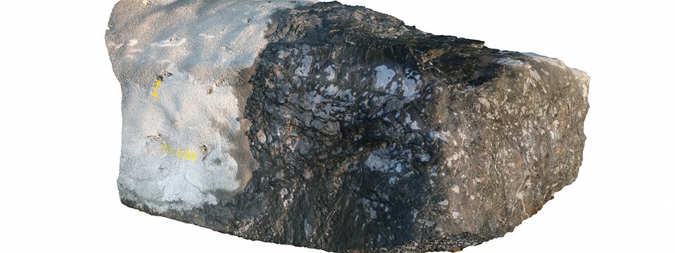
3DM Analyst is able to generate 3D models of historical artifacts in minutes, accurate to tens of microns
if desired, using nothing more than a standard digital camera and a PC. Sample projects will be added to
our website soon!
-
ADAM will be in stand 48 at Austmine 2007
on the 12th and 13th of February demonstrating 3DM Analyst Mine Mapping Suite
and a Rotomotion SR-20 UAV! See the
exhibitions page for details.
-
Added a 24 megapixel merged image and a 33 megapixel merged image representing a single vertical strip of four images and a
single horizontal strip of four images, respectively, from one of our customers' mine pits.
27 images were captured from each of two locations approximately
680m away from the pit wall with a Nikon D1x and 135mm lens, capturing an area of approximately 500m x 250m
of pit wall with a pixel size of 3cm x 3cm on the ground. Because
3DM CalibCam was being used for orientations, control points could be placed safely around the top of the
pit thereby avoiding the need to place them inside the pit itself, without sacrificing accuracy.
Seven control points in total were used, giving quite a high level of redundancy. (Only one was technically
necessary.) The resulting 3D Images were exported to VULCAN
for geotechnical analysis.
-
Asian Surveying and Mapping has an
article on a trial we conducted with one of our customers, using 3DM Analyst and 3DM CalibCam to process images captured
from a helicopter using an EOS 300D, Canon's cheapest digital SLR!
-
Added a case study on the use of
3DM Analyst and
3DM CalibCam at BMA Coal in Queensland, Australia. This article also appears in the February edition
of World Coal magazine.
-
Added the full resolution version of the merged image that appears
in the World Coal magazine article — right-click on the link and select "Save target as..." (or
similar) to save the image on your hard disk, then view it in Photoshop or some other image processing
package. This 27 megapixel image is a real working image that was used for geotechnical analysis by the
Geotechnical Services Group of BMA Coal's Central Queensland Office.
It consists of four images captured from 220m away with a 50mm lens, covering approximately 300m of pit
wall. The pixel size on the ground is approximately 4cm x 4cm, and two control points were used (in
addition to two camera stations) for registering the data in 3D. (The control points can be seen on the
top of the wall.) The images were corrected, colour balanced, and merged using a new feature of the
upcoming version 2.2 release of 3DM CalibCam, currently in testing by all existing 3DM CalibCam users.
-
Added new flyers for 3DM Analyst and 3DM CalibCam.
-
Added a document outlining ADAM
Technology’s recommendations for image capturing using 3DM Analyst and 3DM CalibCam in a mining
environment.

