Get the Flash Player (or allow blocked content) to see the animation.
by 3DM Analyst Heritage Mapping Suite entirely
from pictures of a 15 cm high cuneiform cone.
3DM Analyst Heritage Mapping Suite is a version of ADAM Technology's 3DM Analyst software designed for heritage mapping and archaeological applications.
Because it is based on digital photogrammetry, it brings along all of the benefits that photogrammetry entails:
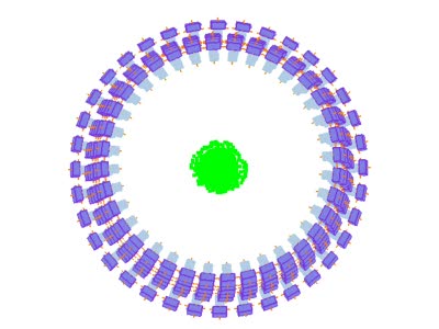
It is inherently scale-free: the same camera and software can be used for the smallest projects (Figure 1), creating digital models of small objects with point densities in the order of 30 microns (over 1,000 points per square millimetres) and accuracies in the order of 15 microns (Figure 2), all the way up to large projects spanning several kilometres in size. The detail and accuracy of the generated data is determined by the time and effort that the user is willing to spend rather than intrinsic limitations on the instruments used — at least down to scales in the order of tens of microns!
It is fast: automatically determining the relative orientation of two images takes less than four seconds, and generating a DTM consisting of 250,000 points from 8 megapixel images takes less than 60 seconds on a modern PC.
It is highly automated: the software is capable of fully automatically determining the relative orientation of any number of images with respect to each other (Figure 1), greatly reducing the workload of staff.
Image registration is automatic: because the 3D data is derived from the images themselves, the images are inherently registered to the 3D surfaces!
"Point cloud registration" is also automatic: because the 3D data is derived from images oriented in a common co-ordinate system, all of the 3D data that is generated from those images is also in that common co-ordinate system. The accuracy of the "co-registration" of the data is on the order of a third of a pixel or better — at least ten times more accurate than the density of the 3D points themselves. This is because the camera orientations were derived from the pixels rather than from interpolating a 3D surface from the point clouds and attempting to co-register the point clouds based on finding the best fit to the surfaces.
It supports the notion of empirical provenance: a record of the journey of "original, unaltered empirical evidence from its initial data capture all the way through the image generation process pipeline to its final digital representation", giving "an account of the process history employed to generate digital virtual representations of our world." Acquiring digitial images of an object or a scene is a well-understood and widely accepted method of recording information about that object or scene. These images can be distributed along with the 3D models, and methods exist for users of those images to ensure that they have not been altered since capture. Because those images are the raw material used by 3DM Analyst to create the 3D models, end-users can reproduce the 3D models themselves as well as verify the accuracy of 3D models against the original images.
3DM Analyst Heritage Mapping Suite can export generated surface models in Alias | Wavefront *.obj file format, allowing the data to be imported into a wide range of modelling packages.
Examples
The following movies show some models created by 3DM Analyst from digitial images of various objects. All images courtesy of Cultural Heritage Imaging in San Francisco.
Get the Flash Player (or allow blocked content) to see the animation.
2 minutes 22 seconds on a 2.4 GHz dual-core PC to represent this surface, with an average point density
of one point per 30 µm × 30 µm, or over 1,000 points per square millimetre.
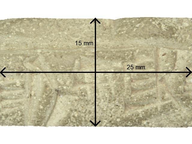
Figure 2 shows a small portion of the same cone used in Figure 1. The images were captured with a Canon EOS 400D ("Digital Rebel XTi" in the US) with a 100 mm macro lens from 235 mm away, yeilding a pixel size on the object of around 13 µm. The most detailed images to date from any of our customers were from a Canon EOS 300D with 100 mm lens from 100 mm away, yielding a pixel size on the object of under 6 µm and an independely-measured planimetric accuracy of 5 µm and depth accuracy of 15 µm.
Get the Flash Player (or allow blocked content) to see the animation.
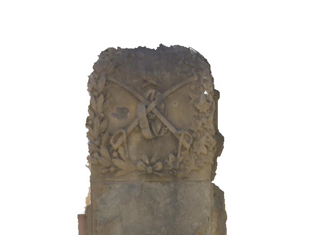
Figure 3 shows the Arguello Gate from the Presidio. For larger objects or outdoor scenes the principles of operation are exactly the same as when the software is being used in a mining environment.